A floodplain is flat or nearly flat land adjacent to a stream/river that experiences regular or periodic flooding.
When a channel overtops its bank the river expands to the full width of the floodplain, and the velocity of the water outside the channel falls considerably.
In these conditions, very fine sediments are deposited, especially as some of the river water gets trapped in isolated pools on the floodplain, like cut off oxbow lakes.

The floodplain often comprises of coarser sediments, and the bit next to the river is normally more raised, which are known as natural levees. These mark where there was the greatest reduction in velocity during a flood.
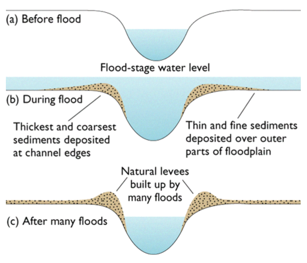
The coarsest and greatest amount of sediment is deposited to form an embankment which raises the height of the bank.
This leads to a natural raising of the channel above the flood plain between 2 levees.
These levees can be built as flood protection, as is this case on the Mississppi where they are 16m high.
Extra: You can remove the sediments that accumulate in the channel during periods of low flow by dredging.
No comments:
Post a Comment