Tuesday 25 March 2014

Risk of erosion

It's a global phenomenon 
  • Damages areas where runoff ends up
  • degrades land that is eroded
  • reduces crop yields
  • eroded soil damages dams, rivers, lakes, buildings and roads
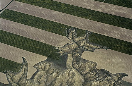
  • Occurs particularly on steeper slopes, on eroidable soils under crops vulnerable to erosion and where unwise farming methods are practised
  • In uplands caused by overgrazing and footpaths
Very High Risk:
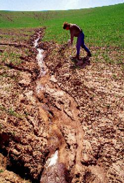
Rills likely to form in most years and gullies may develop in very wet periods

High Risk:
Rills are likely to develop in most seasons during wet periods

Moderate:
Sediment may be seen running to roads, ditches or watercourses
Rills may develop in some seasons during very wet periods

Lower:
Sediment is rarely seen to move but polluting runoff may enter ditches or watercourses


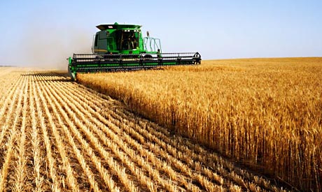
Crops' susceptibility to erosion:

High: Winter cereals, potatoes, maize, sugar beet
Moderate: Winter forage crops eg turnips, oil-seed rape
Low: Permanent grass, woodland

Submergent Fettures: Rias

A Ria is an irregular coastal inlet caused by a relative rise in sea levels resulting in the submergence of a former valley system.


Types of Ecosystems

from the Millenium Ecosystem Assessment reporting catergories

Marine - Ocean deeper than 50m

Coastal - Interface between ocean and land

Inland Water - Permanent water bodies and areas dominated by regular flooding that are inland from the coast


Forest - Land that is at least 40% covered by woody plants taller than 5m
Rainforest Wallpaper

Dryland - Land where annual precipitation is less than two thirds of potential evaporation
File:Kenya scrubland.jpg

Islands -Land surrounded by water with a high proportion of coast to hinterland

Mountains - Land surrounded by water and with a high proportion of coast to hinterland

Polar - High Latitude systems frozen for most of the year


Cultivated - Land dominated by agriculture including orchards or forestry

Urban - Built environments with high human density and population of 5000 or more

Case Study: Mount St Helens

Reasons for growth in Volcanic Tourism industry:
  • Improvements in air travel made places like Hawaii more accessible
  • Global media coverage has increased public awareness of these events
  • World Heritage sites raise profile of places like Giant's causeway
Mt St Helens:
  • Strato volcano in Cascade mountain range
  • Before 1980 it attracted people to hunt, ski and hike
  • Spirit Lake at its base was popular area for fishing, boating and swimming
  • Forests were commercially logged
  • 1980 people flocked to see eruption
  • Vechicles blocked road to spirit lake
  • Souvenir trade: ash in glass vials, tshirts, mugs
  • Forestry service sought safe spots where people could view eruption
  • Mobile trailers set up to show film footage
  • More violent than predicted
  • Claimed 57 lives


Recovery:

Economic:
  • Spirit Lake Memorial Highway
  • Large bridges
  • Five visitor centres
Social:
  • Mt St Helens Volcanic Monument established
Environmental:
  • Several interpretative trails
  • sediment retention structure
  • Pumice plain receeded
  • Outlets cut to release water from lakes created when avalanches dammed streams to decrease flood risk
  • Tunnel constructed at Spirit Lake to maintain safe water level
Tourism Issues:
Conservation: 
  • Only one road leads to site
    • pressure on observatory
    • other attractions help
  • Erosion - hardened park area with 420 vehicle capacity
  • Destruction by vistors
    • trampling can damage pioneer speicies
    • $100 fine for stepping on or picking wildflowers